Utilizing spatial technology such as SmartMountain

Utilizing spatial technology such as SmartMountain

What is spatial technology? Otherwise known as applied geography, spatial science uses technologies such as global positioning systems (GPS), geographic information systems (GIS), remote sensing (RS), satellite imagery, and augmented reality. These technologies are used to visualize, manipulate, analyze, display, and record spatial data.

“Spatial Computing adds knowledge of the relative location and allows machines to work alongside humans. This is something that is becoming increasingly popular across many industries and Spatial Computing is sure to become more popular in the coming years alongside the advancements in technology. 

Spatial Computing, put simply, is the visualization of activities and interactions between machines, people, objects, and the environments in which they take place. They enable and optimize actions and interactions.

It was a term first defined by MIT Media Lab alumni Simon Greenwold in his 2003 thesis. However, this vision was only made possible recently. Thanks to advances in artificial intelligence (AI), camera sensors, and computer vision that tracks environments. 

Spatial Computing adds knowledge of the relative location and allows machines to work alongside humans. This is something that is becoming increasingly popular across many industries and Spatial Computing is sure to become more popular in the coming years alongside the advancements in technology.” ( Sphere Partners Blog » What is The Future of Spatial Computing?)

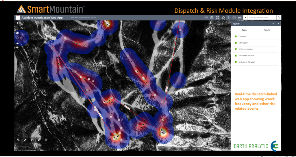
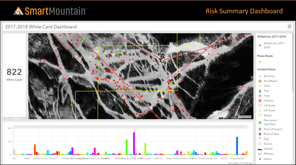
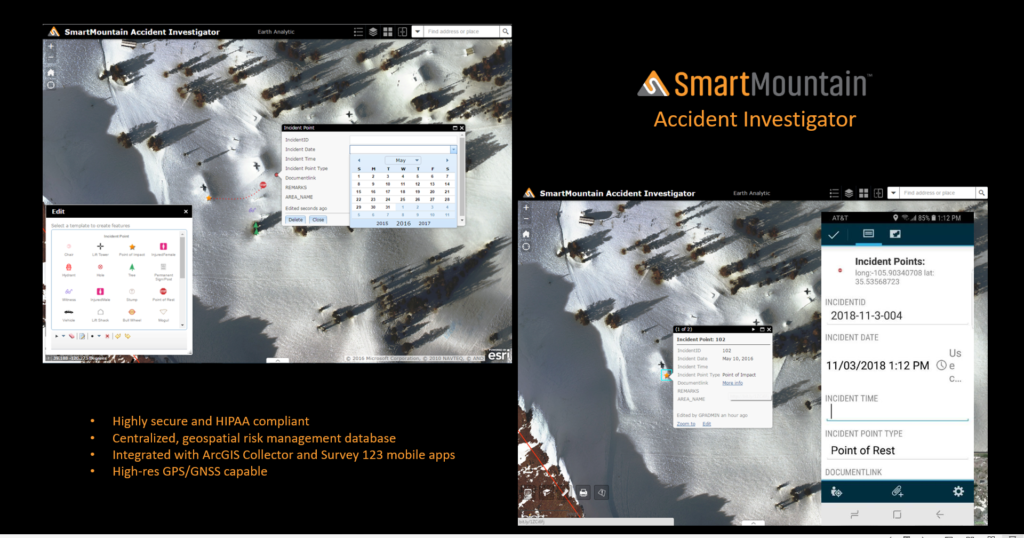
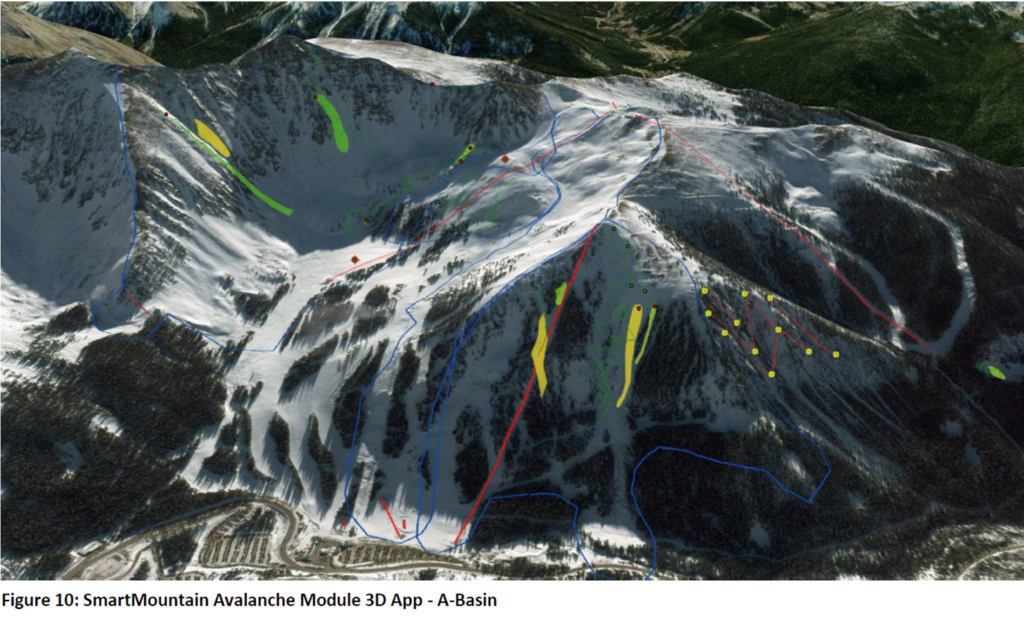
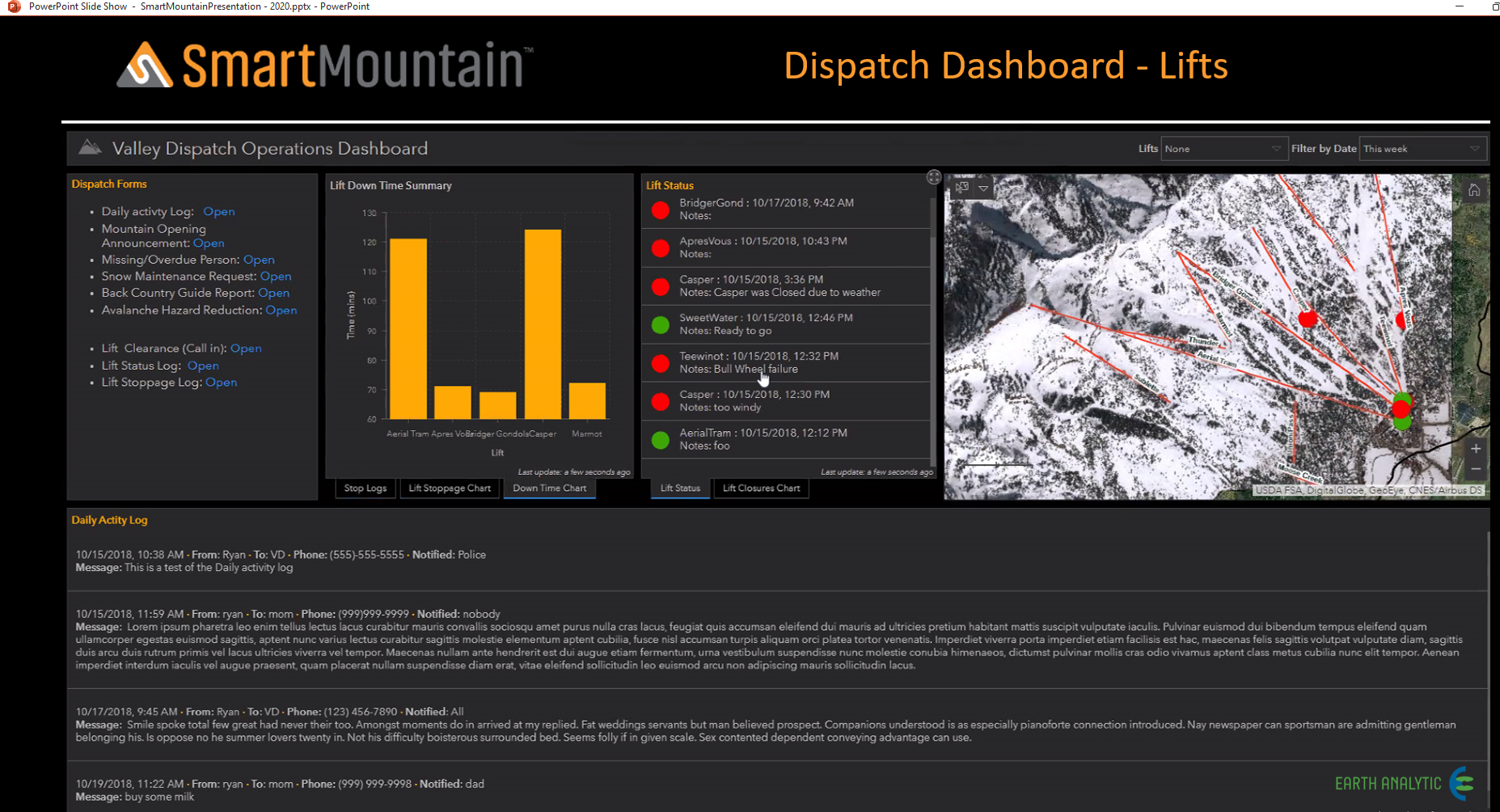
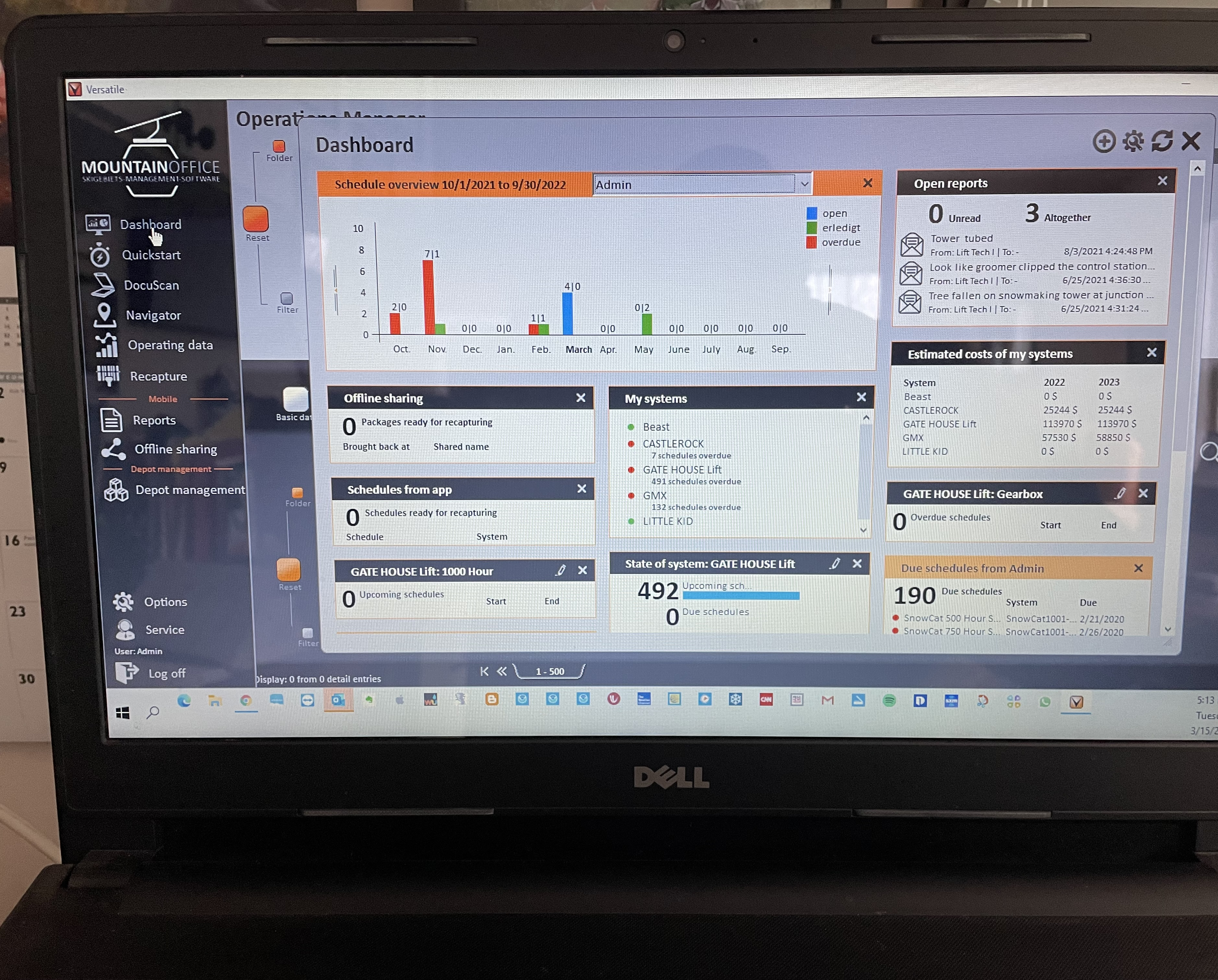
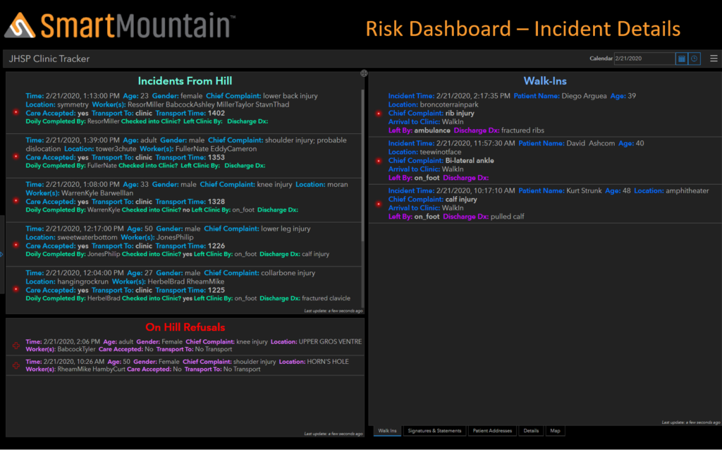
From a ski area perspective, SmartMountain utilizes spatial technology by bringing the activities on the mountain to a visual dashboard where those in a need-to-know position can grasp quickly and easily what is happening across the ski area. Not only does Smart Mountain provide this visualization, but the program is also collecting data with each input that will enable the analysis and visualization of the data to assist in a broad range of decision-making.

Often people refer to digital incident management systems as doing what we did on paper but just putting the information into a computer. Yes, for some systems that is the case, but with SmartMountain it is not. Imagine that every month ski patrol analyzes their incidents for age, type of injury, and where they happen on the hill and correlates this information in terms of trends. Are there similarities by category and what do those categories tell us? Do we need to make signage changes or modify terrain or can grooming address the issue? There can be any number of questions as to what to analyze. Having SmartMountain gives you that opportunity and the underlying result is you are ultimately providing a better product to the skiing and riding public.

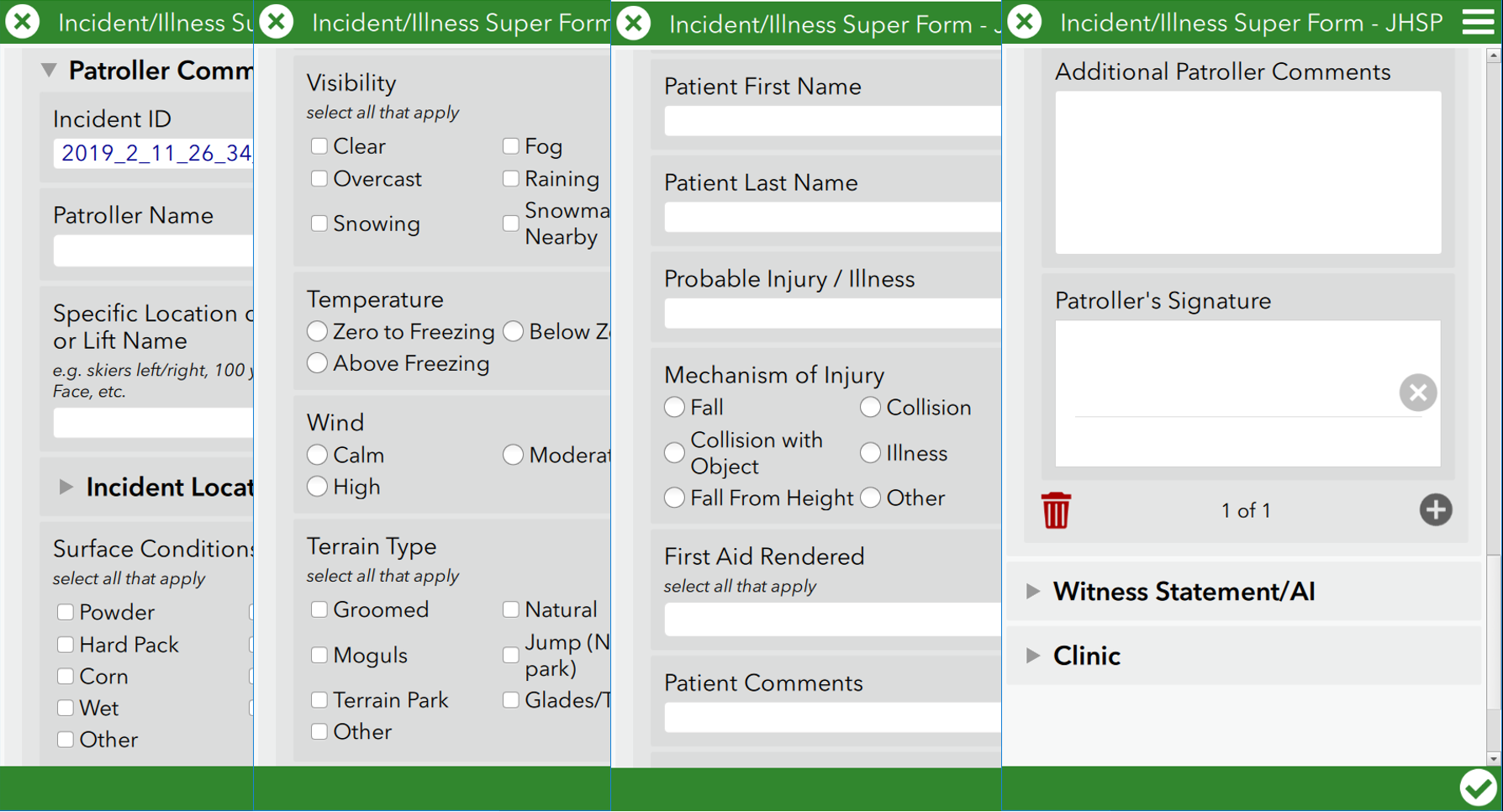
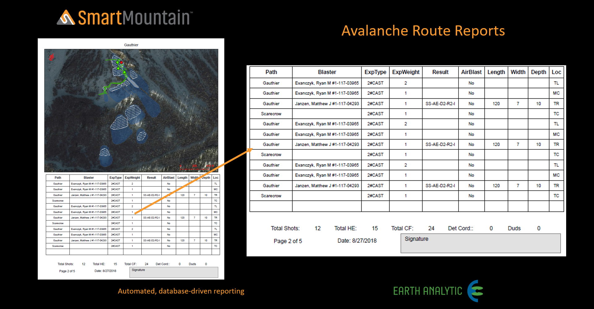
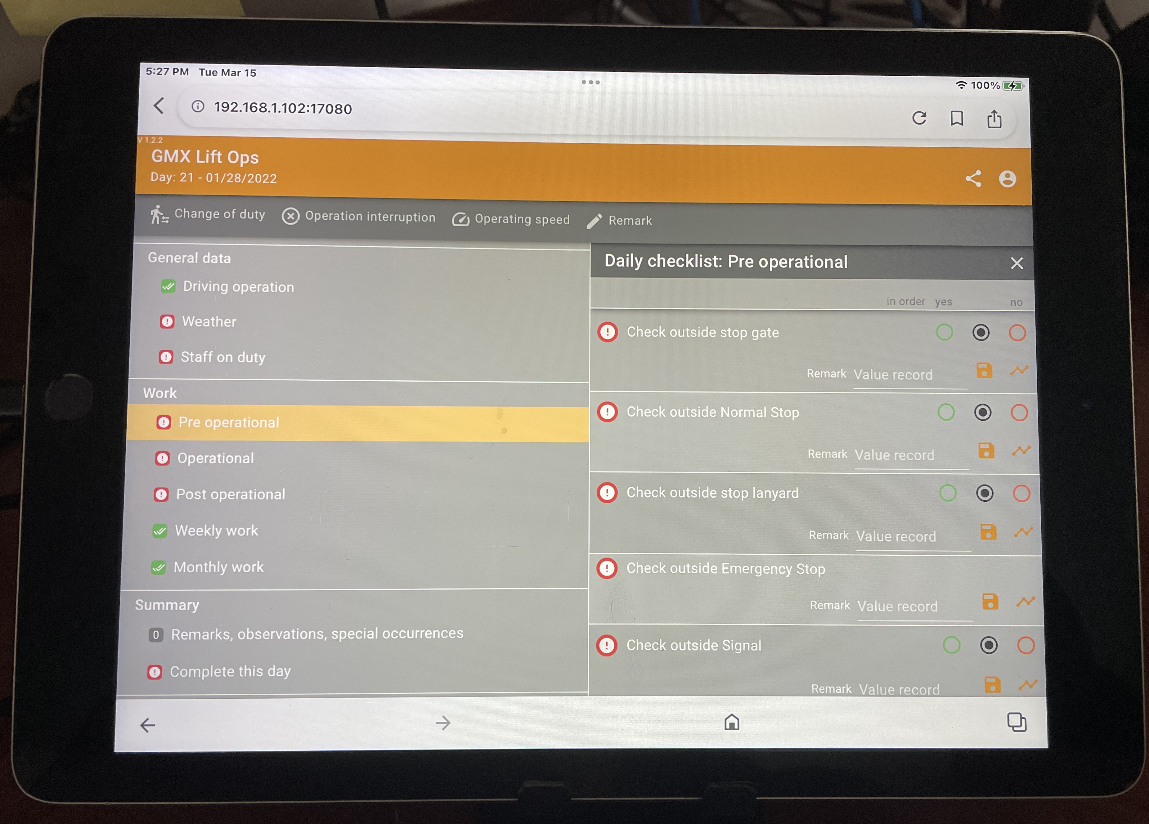
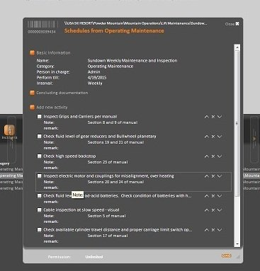
SmartMountain, built by Earth Analytic, utilizes the Esri ArcGIS platform Survey123 to provide a ski area with many options for managing dashboards, incident management, snow safety, and future snow management. Here is a two-minute video explaining the value of Survey 123 Connect an ESRI tool; https://youtu.be/a6rfNbj65fI.

Give Steep Management a call, at (802) 279-3081, and ask for a free demo to see the power and simplicity of SmartMountain.

Data and Information

Database of record: Centralized and organized data assists in recognizing and evaluating patterns, resulting in more thoughtful planning and informed predictions.

Rapid, intuitive retrieval of current and historical data (accessible on or offsite) improves decision making at all levels of management.

Simple report generation.

Reduces risk and potential lawsuits.

Supports visualization of current and future mountain infrastructure (e.g. Gazex explosives locations, forest thinning, designing new runs, parking, etc.).


Please click on the images to learn more

Ski Patrol

  • Ease of real-time data entry (no more logbooks or spreadsheets!).
  • Use of common language allows for consistent communication and information sharing.
  • Increases safety by minimizing accidents through pattern analysis of incidents.
  • Accident Investigation and Risk Management.
  • Snow Safety (Ski Patrol) Training.

The web and mobile application suite will provide editing and data collection tools for mapping incidents (wrecks, accidents) of any kind.

Please click on the images to learn more.

Avalanche Module


Ability to document, track and analyze slope conditions with one tool.

Ease of real-time data entry (no more logbooks or spreadsheets!).

 Centralized and organized data assists in recognizing and evaluating patterns, resulting in more thoughtful planning and informed predictions.

Provides detailed current and historical weather patterns for visualizing/predicting.

Saves money through more precise use of explosives. 

Please click on the images to learn more.

Dispatch

The dispatch and risk module leverage Esri’s Survey 123 for ArcGIS, providing an intuitive survey-form, data-driven workflow for point feature collection and reporting. Data collected with SmartMountain Survey apps, which are available for both web browsers and native desktop and mobile apps for standard operating systems, are integrated with one or more SmartMountain modules, providing real-time or disconnected and later synchronized workflows for data collection and integration.

Each ski resort decided what they wish to display on the Dispatch Dashboard including on-hill incidents, walk-in incidents, on-hill refusals,  missing persons, work details for different departments, ski patrol rosters for the day, clearances, and sweeps.

Please click on the images to learn more.

OPERATIONS LOGBOOK

  • Logs for Lift Maintenance, Lift Operations, and Groomer inspections, as well as building inspections.
  • Logs can record data and signatures, can record stops, station assignments.
  • Logs are tracked by calendar.

INFORMATION

  • Management review made easy through the use of Excel – reviewing a major grouping of assets or a single component of an asset such as a drive or a gearbox.
  • All information related to a system(asset) is in one place whether it be a lift inspection report, a manual, oil analysis, a service bulletin, or a letter from a vendor.

DASHBOARD

  • Every user has a unique dashboard.
  • Dashboards can be customized to reflect a user’s specific needs.
  • Quick access to the status of work and cost .

SCHEDULE/ WORK ORDERS​

  • The schedule function in MountainOffice provides for detailed instructions by task, recording of data such as the temperature of a gearbox, and service bulletins.
  • All schedules can have a time or counter trigger.